This is definitely the long way. A ride via the Water Supply Pipeline, the Aquaduct, Prospect Reservoir, Western Sydney Regional Park and Orphan School Creek. I think it is one of the nicest rides in Sydney and normally I ride from Marrickville via Homebush Bay via the Cooks River Trail and the M4 motorway cycletrack through Parramatta and back via Bankstown, then onto the M5 Linear Cycleway, before cutting through Kings Grove to Cup and Saucer Creek and the Cooks River Trail making the total journey 100km.
Prospect Loop Notes

|
Place |
Type |
Route |
Distance |
Riding Time |
Notes |
|
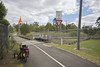
Guildford Railway Station |
Start |
Shared Footpath |
0 |
Follow shared cycleway on right side of road. |
|
|
Pedestrian Bridge |
Turnoff |
Shared Footpath |
0.47 |
0:04:02 |
At the top of hill, go over bridge over Railway line, across the road, then left and right onto the cycleway beside the pipeline. |
|
Military Road |
Road Crossing |
Cycleway |
 |
||
|
Byron Road |
Road Crossing |
Cycleway |
|||
|
Guildford Road |
Road Crossing |
Cycleway |
|||
|
Harris Street |
Road Crossing |
Cycleway |
|||
|
Fowler Street |
Road Crossing |
Cycleway |
When I was there they were doing work on the cycleway. So I had to detour. Turn Right onto Fowler Street and left at Frank Street. |
||
|
Bowden Street |
Shared Footpath |
||||
|
Sydney Water Field Services |
Cycleway |
Turn Left onto the Cycleway. |
|||
|
Frank Street |
Shared Footpath |
||||
|
Sydney Water Field Services |
Cycleway |
Turn Left onto the Cycleway. |
|||
|
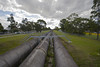
Start of aqueduct |
Cycleway |
2.42 |
0:10:05 |
Follow the Aqueduct. |
|
|
Albert Street |
Underpass |
Cycleway |
|||
|
Woodpark Road and Sherwood Road |
Underpass |
Cycleway |
|||
|
Cumberland highway |
Underpass |
Cycleway |
3.92 |
0:05:13 |
|
|
Bayfield Road |
Underpass |
Cycleway |
 |
||
|
Gipps road |
Underpass |
Cycleway |
7.17 |
0:11:28 |
|
|
Reconciliation Drive |
Road Crossing |
Cycleway |
This is a bit dangerous. There is quite a bit of road-works and that will take some time to complete. There a light controlled crossing. |
||
|
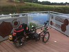
Prospect picnic ground |
Car Park |
Road |
9.82 |
0:11:15 |
Public Toilets, water. |
|
Parkland Road |
Road |
This road has entries for Cyclists to get past the gate.
|
|||
|
Wetherill Park |
Cycleway |
A short section of cycleway gets you around the locked gate. |
|||
|
Southern Road |
Road |
||||
|
Wetherill Park |
Cycleway |
A short section of cycleway gets you around the locked gate. |
|||
|
Chandos road |
Crossing |
Cycleway |
12.98 |
0:17:07 |
From here on it is it hilly and at times steep. |
|
The Horsley drive |
Crossing |
Cycleway |
14.56 |
0:05:53 |
Hilly |
|
Horse Track Crossing |
Crossing |
Cycleway |
You pass a gravel horse track. To the left, over the water supply channel is the Pimelea Picnic Area. |
||
|
Cotswold Road |
Crossing |
Cycleway |
16.68 |
0:08:22 |
The Diary Picnic ground, Hilly. |
|
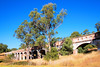
Western Sydney Regional Park |
Cycleway |
You ride alongside the national equestrian course. Very steep sections |
|||
|
Calmsley Hill Children’s Farm |
Crossing |
Driveway |
17.76 |
0:04:23 |
Not very well designed if I remember correctly. Turn left onto the driveway of the farm. |
|
Darling Street |
Crossing |
Cycleway |
From here you leave the hills and it is pretty much downhill all the way to the end. |
||
|
Dalbertis Street |
Crossing |
Cycleway |
|||
|
Maxwell Place |
Street |
A quiet Suburban Street. I think you are allowed to ride on the footpath. |
|||
|
Province Street |
Street |
Turn Left onto Province Street. (Keep heading down hill.) |
|||
|
Abbotsbury Shopping Center |
Street |
17.35 |
0:03:00 |
footpath track or road |
|
|
Stockdale Crescent Reserve. |
Cycleway |
Has a little lake. Head to the left around the lake.
|
|||
|
Cowpastures road |
Overpass |
Cycleway |
19.15 |
0:03:59 |
The bridge. You will understand what I mean. Go up and over, then down, around, down, around, at the bottom, turn right and then right again. |
|
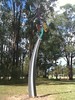
Belfield Road |
Crossing |
Cycleway |
Metal sculptures
|
||
|
Sweethaven road |
Crossing |
Shared Footpath |
20.97 |
0:06:57 |
Stay on your side. Go left along the road. Then cross over and follow the cycleway again. |
|
Powhatan Street Reserve |
Cycleway |
For quite some time you will follow orphan school creek |
|||
|
Minmosa Road |
Crossing |
Cycleway |
Cross Over, Take left forks to keep following creek, on the right hand side as you head downstream. |
||
|
Transit Way |
Crossing |
Cycleway |
|||
|
Moonlight Road |
Crossing |
Cycleway |
|||
|
Smithfield road |
Underpass |
Cycleway |
23.85 |
0:11:21 |
Take left fork before Smithfield Road to go under it. After this you will now be on the left side of the creek. |
|
Hamilton road |
Crossing |
Cycleway |
|||
|
King Street |
Crossing |
Cycleway |
|||
|
Bridge |
Cycleway |
A bridge over Orphan School Creek. You are now on the right side of the creek. |
|||
|
Cambridge street |
Crossing |
Cycleway |
26.04 |
0:07:40 |
Otherwise known as the Cumberland Highway. You go under it using the storm water drain. I guess you should be wary on wet days as there may be lots of storm water. |
|
Bridge |
Cycleway |
Cross back over to the left side of Orphan School Creek. |
|||
|
Fork |
Cycleway |
Stay left. Do not go over the bridge over the creek. |
|||
|
Fork |
Cycleway |
Stay Right and go down towards Orphan School Creek. Left Canley Heights Right Canley Vale |
|||
|
Bridge |
Cycleway |
Cross back to the right side of Orphan School Creek. |
|||
|
Sackville Street |
Underpass |
Cycleway |
Go under. |
||
|
Sackville Street |
Service Road |
Shared Footpath |
|||
|
Freeman Avenue |
Crossing |
Shared Footpath |
Cross over Freeman Avenue and continue along shared footpath. |
||
|
Adams Park |
Cycleway |
Turn Left onto the Cycleway. Head for Fairfield/Parramatta |
|||
|
Railway Parade and Railway Line |
Underpass |
Cycleway |
28.77 |
0:11:32 |
After going under both, turn right. If you want to go back to the start, turn left and then cross the creek using the very narrow bridge. Then follow the cycle path thar runs beside the railway line back to the start. |
|
First Avenue |
Road |
I didn’t actually go to the railway station. I turn left at the intersection before and rode back to Marrickville. |
|||
|
Canley Vale Railway Station. |